Soil salinity levels, using unmanned aerial vehicles imagery, neural networks and decision trees
Keywords:
drones, multispectral images, precision agriculture, reflectances, salinity index.Abstract
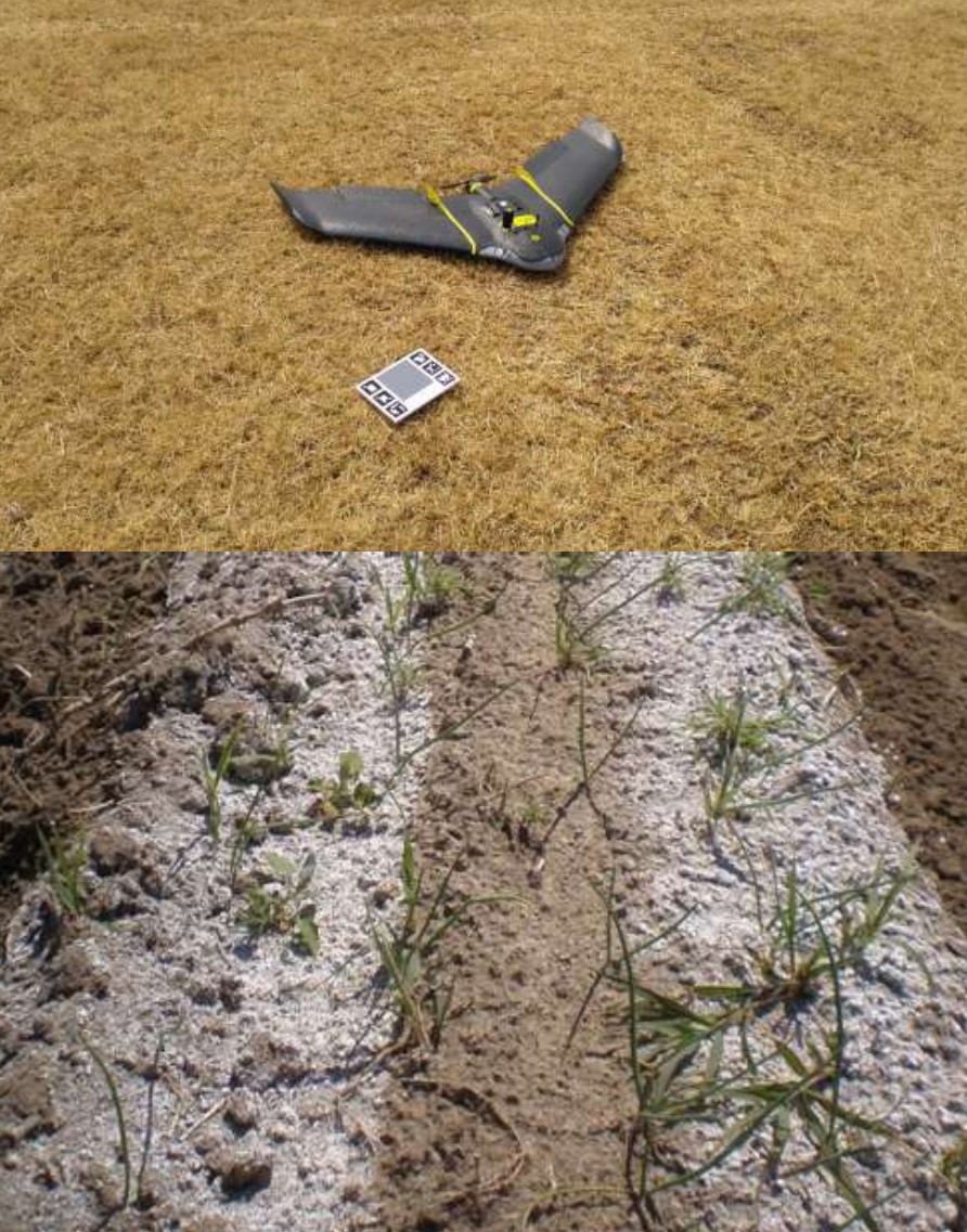
Soil salinity is a global problem that threatens crop growth, and yields and impedes the and sustainable development of modern agriculture with major staple crops unable to complete their life cycle when soil NaCl concentrations exceed 200 mM. More than one third of the world's irrigated plots are affected by salinization. Unmanned aerial vehicles offer a viable alternative for acquiring remote sensing data. One way to classify and detect soil salinity variables are neural networks and decision trees. The objective of this work is the detection and classification of soil salinity through the use of multispectral images captured by drones as well as the use of decision tree models and neural networks, to estimate salinity variables: Exchangeable Sodium Percentage (ESP), Adjusted Sodium Adsorption Ratio (SARaj) and sodium concentration (mEq L-1). Agricultural soil with salinity problems was sampled, processed in the laboratory, the results were interpreted and classified according to salinity levels. A drone overflight was conducted to captured images and extract reflectances of the four multispectral bands (Green, red, red edge and near infrared). The salinity indexes were calculated to classify soil salinity using neural networks and decision trees. The neural networks classified 82.6% of the samples in the medium level category of ESP estimation. The model also presented an accuracy of 71.88% when determining sodium ion concentration in the neural networks. The Research work showed that it is possible to classify soil salinity with acceptable precision from images captured with unmanned aerial vehicles. Neural network models showed better accuracy in the estimation of soil salinity indicators with respect to decision trees. These technological procedures can be applied in soil salinity mapping to know the affected areas in an easy and fast way.
References
1. Chunzhao, Z., Heng, Z., Chunpeng, S., Jian-Kang, Z. and Shabala, S. (2020) “Mechanisms of Plant Responses and Adaptation to Soil Salinity”. The Innovation, 1: (1), 100017. https://doi.org/10.1016/j.xinn.2020.100017
2. Finger, R., Scott, M. S., Benni, N. L and Walter, A. (2019) “Precision Farming at the nexus of agricultural production and the environment”. Annual Review of Resource Economics, (1): 313-335. https://doi.org/10.1146/annurev-resource-100518-093929
3. Boursianis, A. D., Papadopoulou, M. S., Diamantoulakis, P., Liopa, T. A., Barouchas, P., Salahas, G., Karagiannidis, G., Wan, S. and Goudos, S. K. (2020) “Internet of Things (IoT) and Agricultural Unmanned Aerial Vehicles (UAVs) in smart farming: A comprehensive review”. Internet of Things, 1001187, 2542-6605. https://doi.org/10.1016/j.iot.2020.100187.
4. Klemas, V. V. (2015) “Coastal and environmental remote sensing from unmanned aerial vehicles: An Overview”. Journal of Coastal Research, 31(5): 1260-1267. https://doi.org/10.2112/JCOASTRES-D-15-00005.1.
5. Sacristan, F. R. (2006) “La tecnología al servicio del medio ambiente”. Revista de la Facultad Nacional de Salud Pública. 24: 1. http://www.scielo.org.co/scielo.php?script=sci_arttext&pid=S0120-386X2006000100014&lng=en&nrm=iso>. ISSN 0120-386X.
6. Abbas, A., Khan, S., Hussai, N., Hanjra, M. A. and Akbar, S. (2013) “Characterizing soil salinity in irrigated agriculture using a remote sensing approach”. Physics and Chemistry of the Earth, 55-57, 43-52. https://doi.org/10.1016/j.pce.2010.12.004
7. Daliakopoulos, I.N. and Tsanis, I. K. (2014) Greece: Agro-pastoral over-exploitation and its implications in Messara Valley (Crete). Paris, CIHEAM. CIHEAM Watch Letter 28, Land issues in the mediterranean countries.
8. Torres, J. A. I. (2018) Deep learnig. Introducción practicas con Keras (primera parte). Barcelona, Ed. What this space.
9. Wang, F., Nie, F., Li, Z., Yu, W. and Ren, F. (2020) “A linear multivariate binary decision tree classifier based on K-means splitting”. Pattern Recognition, (107): 107521. https://doi.org/10.1016/j.patcog.2020.107521
10. SEGOB, Secretaría de Gobernación (2000) Norma Oficial Mexicana NOM-021-RECNAT-2000, Que establece las especificaciones de fertilidad, salinidad y clasificación de suelos, estudios, muestreo y análisis. Diario Oficial de la Federación. Ciudad de México. Edición 31 de diciembre de 2002. 64 p.
11. Clesceri, L. S., Greenberg, A. E. and Eaton, A. D. (1998) Estandar methods for examination of water and wastewater. Washington, D. C. U.S.A 20 ed. American Public Health Association (APHA), American Water Works Association. Water Pollution Control Federation.
12. Richards, L. A. (1982) Suelos Salinos y Sódicos. Ciudad de México. Editorial Limusa.
13. Can, C. A., Ramírez, A. C., Ortega, E. H. M., Trejo, L. C. and Cruz, D. J., (2008) “Evaluación de la relación de adsorción de sodio en las aguas del río Tulancingo, estado de Hidalgo, México”. Terra Latinoamericana, 26 (3), 243-252.
14. Bower, C. A., Ogata, G. and Tucker, J. M. (1968) “Sodium hazard of irrigation waters as influenced by leaching fraction and by precipitation or solution of calcium carbonate”. Soil Science, 106: (1), 29-34.
15. Aceves, N. E. (2011). El ensalitramiento de los suelos bajo riego. Cd de México. Editorial Biblioteca Básica de Agricultura.
16. Allbed, A., Kumar, L. and Aldakheel, Y. Y. (2014) “Assessing soil salinity using soil salinity and vegetation indices derived from IKONOS high-spatial resolution imageries: Applications in a date palm dominated region”. Geoderma, 230-231, 1-8. http://dx.doi.org/10.1016/j.geoderma.2014.03.025
17. Allbed, A. and Kumar, L. (2013) “Soil salinity mapping and monitoring in arid and semi-arid regions using remote rensing technology: A review”. Advances in remote sensing, 2: 373-385. DOI:10.4236/ars.2013.24040
18. Statgraphics, Neural network classifier (2020) Classifierneuralclassifier.sgp. (Consultado el 12 de agosto de 2020).
19. Phillips, N. D., Neth, H., Woike, J. K. and Gaissmaier, W. (2017) “FFTrees: A toolbox to create, visualize and evaluate fast-and-frugal decision tres”. Judgment and Decision Making, 12: (4), 344-368. http://journal.sjdm.org/17/17217/jdm17217.pdf
20. Alexakis, D. D., Daliakopoulos, I. N., Panagea, I. S. and Tsanis, I. K. (2018). “Assessing soil salinity using WorldView-2 multispectral images in Timpaki, Crete, Greece”. Geocarto International, 33: (4) 321–338. DOI: 10.1080/10106049.2016.1250826.
21. Rhyma, P.P., Norizah, K., Hamdan, O., Faridah, I. H. and Zulfa, A. W. (2020) “Integration of normalised different vegetation index and Soil-Adjusted Vegetation Index for mangrove vegetation delineation”. Remote sensing applications: Society and environment, 17: 100280. https://doi.org/10.1016/j.rsase.2019.100280
22. Taghizadeh, M. R., Schmitdt, K., Toomanian, N., Heung, B., Behrens, T., Mosavi, A., Band, S.S., Amirian, C. A., Fathabadi, A. and Scholten, T. (2021) “Improving the spatial prediction of soil salinity in arid regions using wavelet transformation and support vector regression models”. Geoderma, 383: 114793. https://doi.org/10.1016/j.geoderma.2020.114793
23. Gadzinski, G. and Castello, A. (2020) “Fast and frugal heuristics augmented: when machine learning quantifies bayesian uncertainty”. Journal of behavioral and experimental finance, 26: 100293. 10.1016/j.jbef.2020.100293.
24. Amir, D. M., Naderi, A., Ghorbani, Y., Mehrpouyan, A. and Bakhshi, A. (2020) “Nity mapping by remote sensing south of Urmia Lake, Iran”. Geoderma Regional, 22: e00317. https://doi.org/10.1016/j.geodrs.2020.e00317
25. Zewdu, S., Suryabhagavan, K. V. and Balakrishnan, M. (2017) “Geo-spatial approach for soil salinity mapping in sego irrigation farm, South Ethiopia”. Journal of the Saudi Society of Agricultural Sciences, 16: (1), 16-24. https://doi.org/10.1016/j.jssas.2014.12.003.
26. Ramos, T. B., Castanheira, N., Oliveira, A. R., Paz, A. M., Darouich, H., Simionesei, L., Farzamian, M. and Goncalvez, M. C. (2020) “Soil salinity assessment using vegetation indices derived from Sentinel-2 multispectral data, application to Lezíria Grande, Portugal”. Agricultural Water Management, 241: 106387. https://doi.org/10.1016/j.agwat.2020.106387